TEST QUIZ 11
Quiz Summary
0 of 98 questions completed
Questions:
Information
You have already completed the quiz before. Hence you can not start it again.
Quiz is loading…
You must sign in or sign up to start the quiz.
You must first complete the following:
Results
Results
0 of 98 Questions answered correctly
Your time:
Time has elapsed
You have reached 0 of 0 point(s), 0
Earned Point(s): 0 of 0, (0)
0 Audio(s)/Essay(s) Pending (Possible Point(s): 0)
Categories
- Not categorized 0%
- TOPO Demo 0%
- TOPO Mock 1 0%
- TOPO Mock 2 0%
- TOPO Mock 3 0%
- TOPO Practice 0%
- Review
- Answered
- Correct
- Incorrect
-
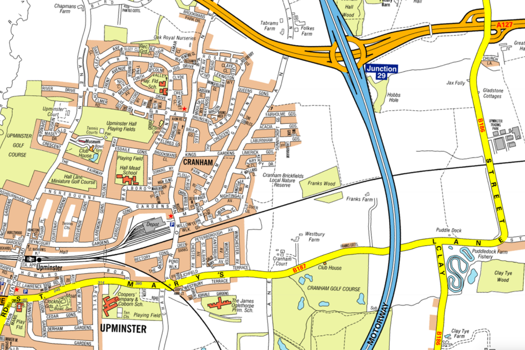
Question 1 of 98
1. Question
Look at the map. Which Junction on the M25 is nearest to Upminster?
 CorrectIncorrect
 -
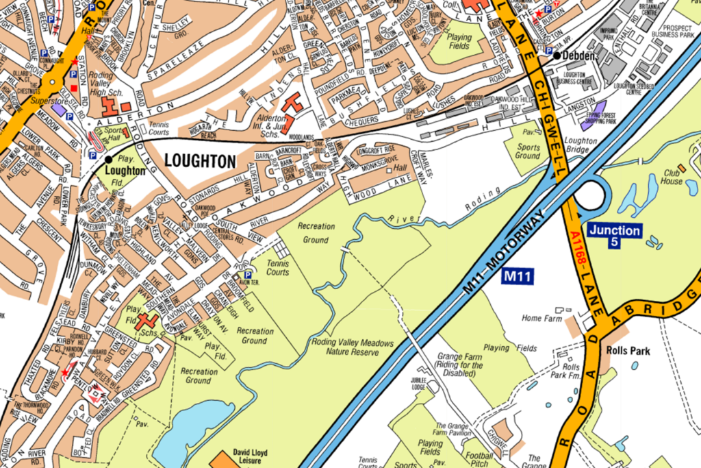
Question 2 of 98
2. Question
Look at the map. Which Junction on the M11 is nearest to Loughton?
 CorrectIncorrect
 -
Question 3 of 98
3. Question
Look at the map.
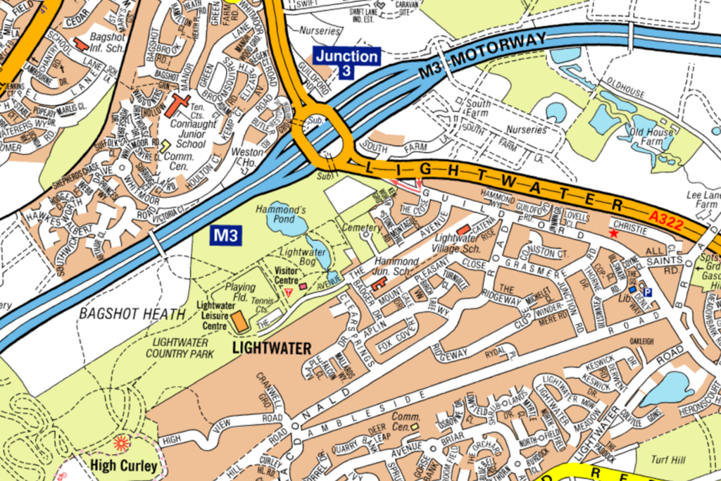
Which Motorway would you use to get to Lightwater?
CorrectIncorrect -
Question 4 of 98
4. Question
Look at the map.
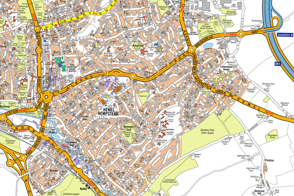
Which Motorway would you use to get to Hemel Hempstead?
CorrectIncorrect -
Question 5 of 98
5. Question
Look at the map. What is the last Motorway you would use to get to Slough?
 CorrectIncorrect
 -
Question 6 of 98
6. Question
Look at the map.
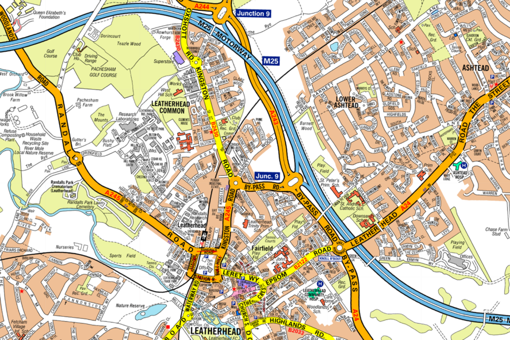
Which Junction on the M25 is nearest to Leatherhead?
CorrectIncorrect -
Question 7 of 98
7. Question
Look at the map.
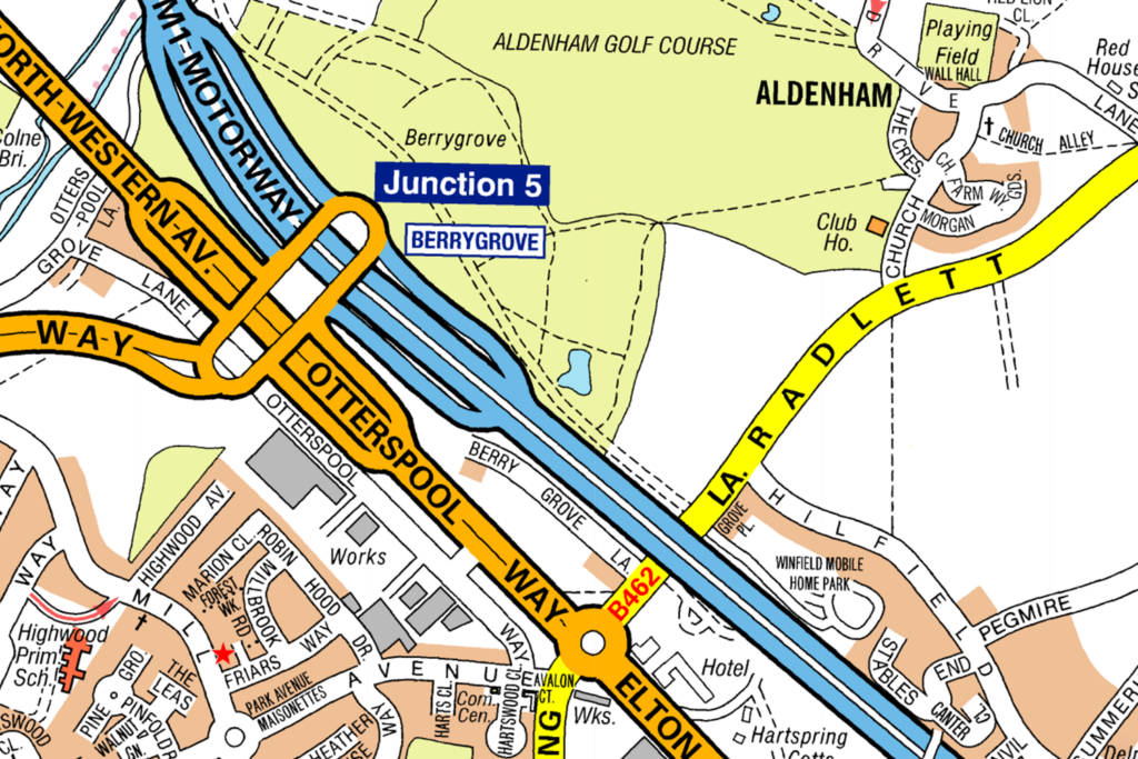
Which Junction on the M1 is nearest to Aldenham?
CorrectIncorrect -
Question 8 of 98
8. Question
Look at the map.
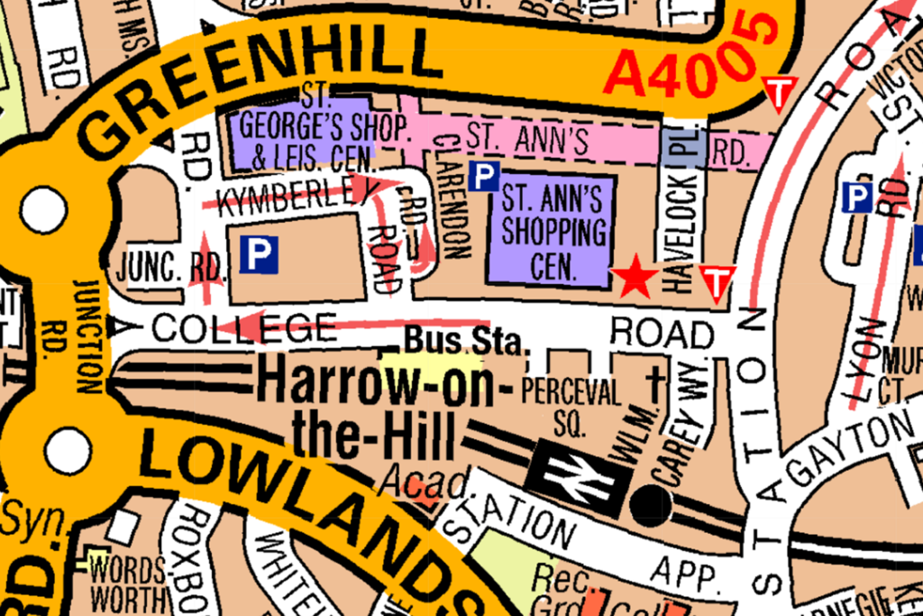
What is the nearest shopping centre to Harrow-on-the-Hill Bus Station?
CorrectIncorrect -
Question 9 of 98
9. Question
Look at the map.
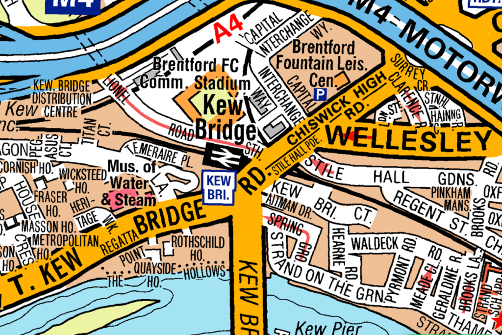
What is the nearest National Rail station to the Museum of Water & Steam?
CorrectIncorrect -
Question 10 of 98
10. Question
Look at the map.
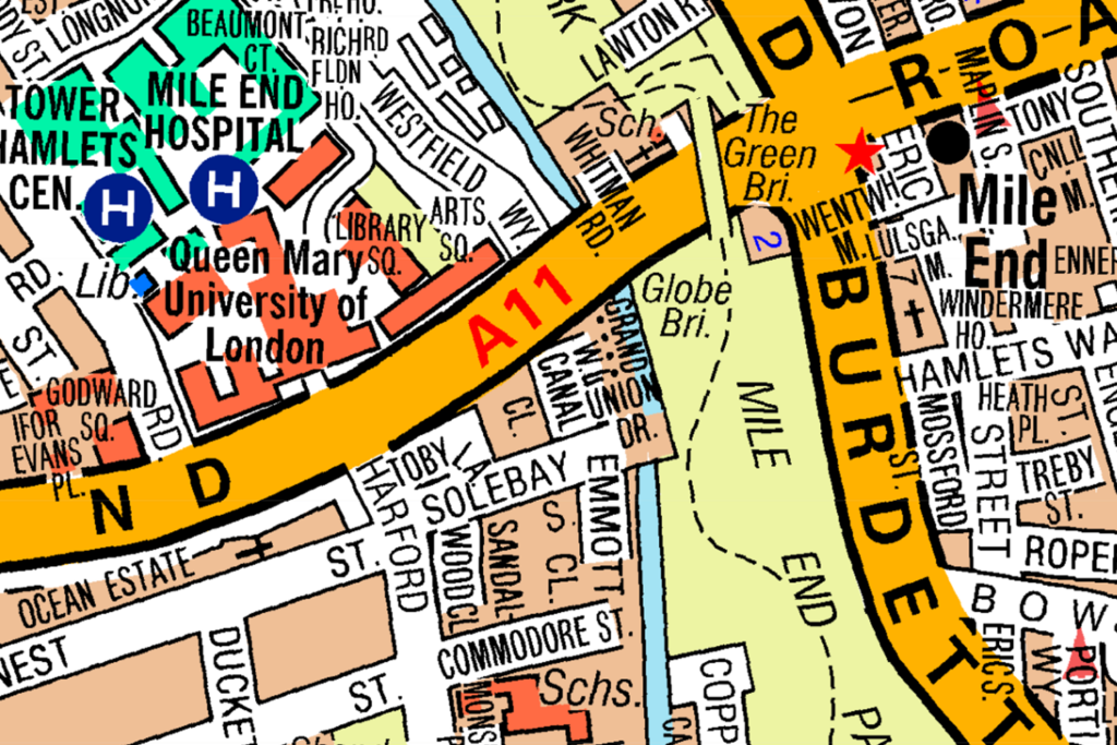
Which university is closest to Mile End?
CorrectIncorrect -
Question 11 of 98
11. Question
Look at the map.
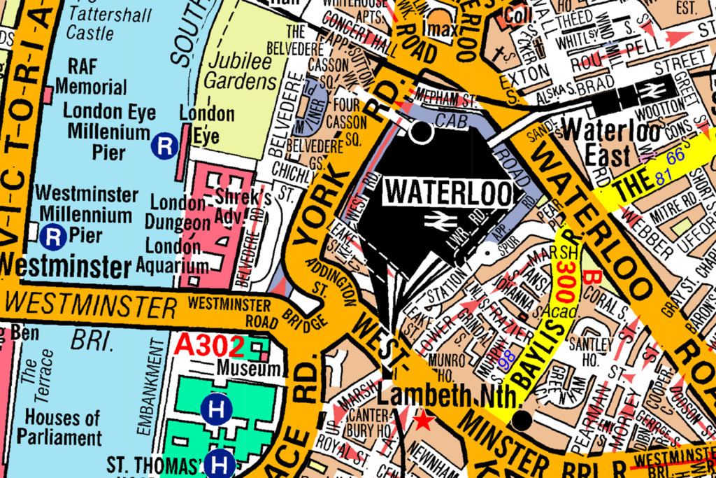
What is the nearest National Rail Station to the London Eye?
CorrectIncorrect -
Question 12 of 98
12. Question
Look at the map.
Which road is closest to Westminster Bridge?
CorrectIncorrect -
Question 13 of 98
13. Question
Look at the map.
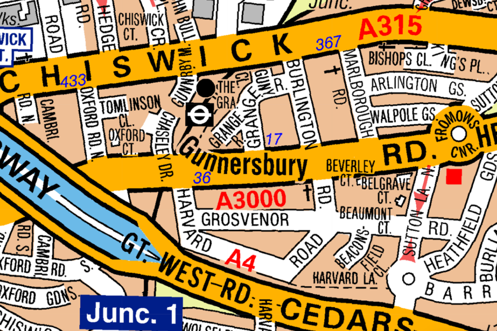
What is the closest road to Gunnersbury Underground Station?
CorrectIncorrect -
Question 14 of 98
14. Question
Look at the map.
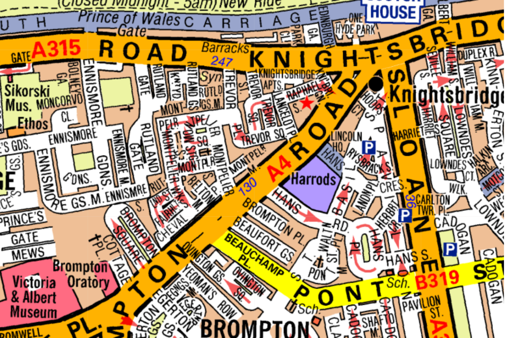
Which road is closest to Harrods?
CorrectIncorrect -
Question 15 of 98
15. Question
Look at the map.
Which Motorway would you use to get to Stansted?
CorrectIncorrect -
Question 16 of 98
16. Question
Look at the map.
What direction are you travelling in, if you drive up Wood Lane from Westway:
CorrectIncorrect -
Question 17 of 98
17. Question
Look at the map. What direction are you travelling in, if you turn right onto Mollison Avenue from A1010:
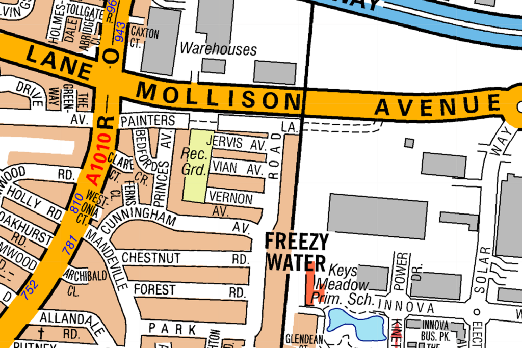 CorrectIncorrect
 -
Question 18 of 98
18. Question
Look at the map. Which direction do you travel on the A404 to go from Kensal Town to Kensal Green?
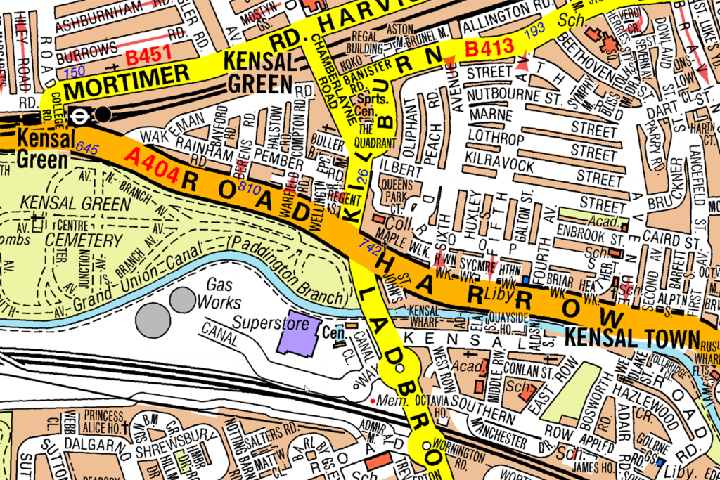 CorrectIncorrect
 -
Question 19 of 98
19. Question
Look at the map.
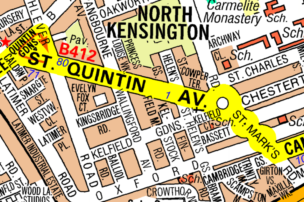
Which direction do you travel in to go from St Mark’s Road to Quintin Gardens?
CorrectIncorrect -
Question 20 of 98
20. Question
Look at the map.
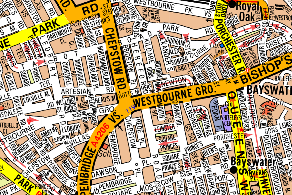
What direction are you travelling in, if you drive down Westbourne Grove from Chepstow Road:
CorrectIncorrect -
Question 21 of 98
21. Question
Look at the map.
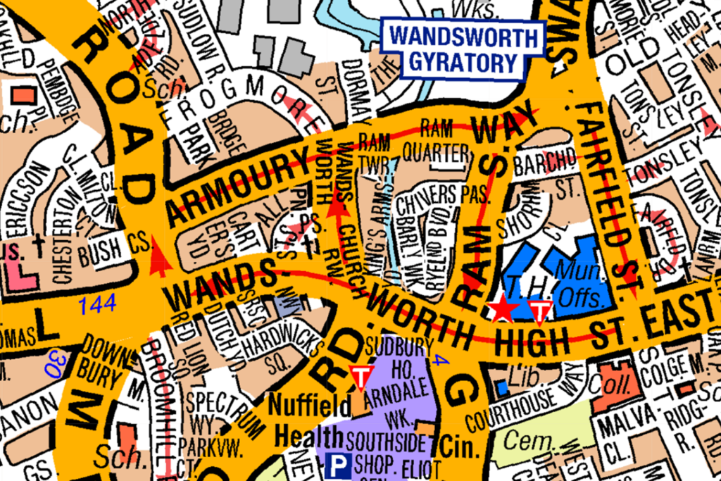
What direction are you travelling in, if you drive down Wandsworth High street from Fairfield street:
CorrectIncorrect -
Question 22 of 98
22. Question
Look at the map.
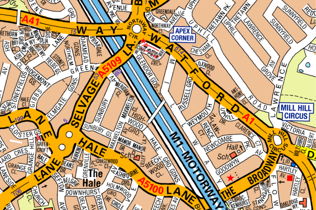
Which direction do you travel in to go from Mill Hill Circus to Northway Circus?
CorrectIncorrect -
Question 23 of 98
23. Question
Look at the map.
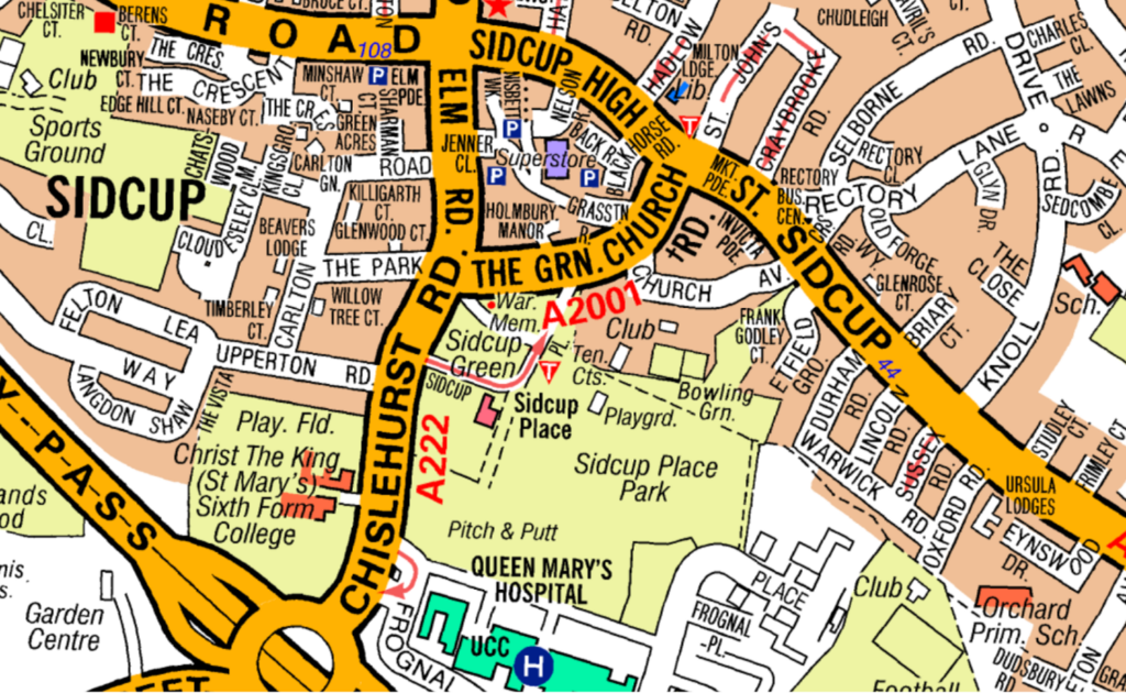
Which direction do you travel in to go from Chislehurst Road to Sidcup High Street via The Green Church Road?
CorrectIncorrect -
Question 24 of 98
24. Question
Look at the map.
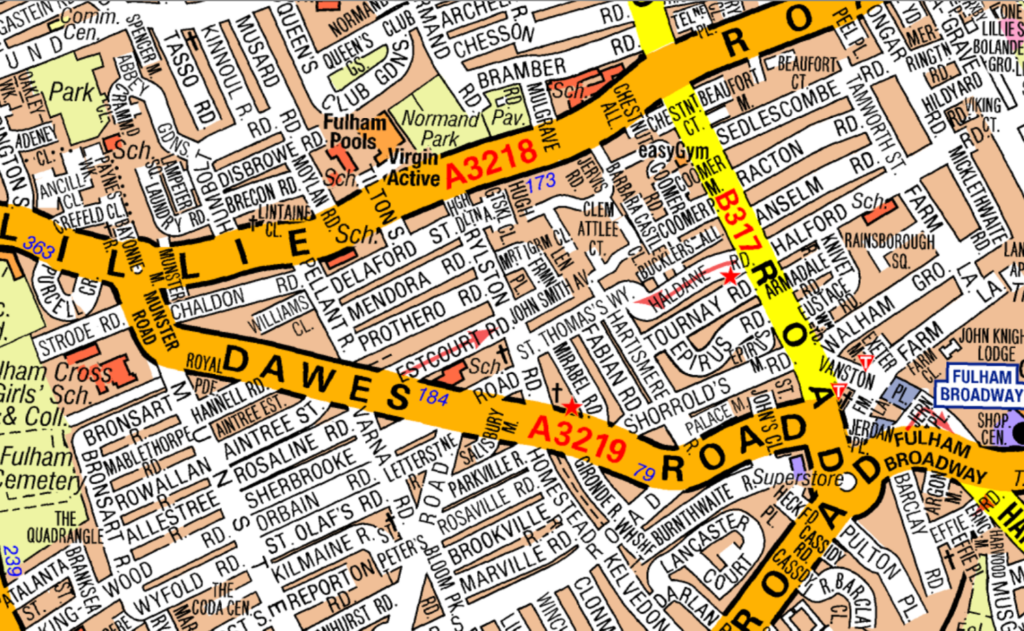
What direction are you travelling in, if you drive down A3219 from A3218:
CorrectIncorrect -
Question 25 of 98
25. Question
Look at the map.
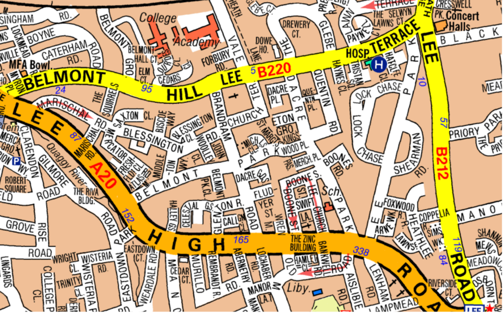
Which direction do you travel in to go from Lee High Road to Lee Road via B220?
CorrectIncorrect -
Question 26 of 98
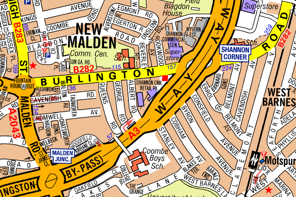
26. Question
Look at the map. What direction are you travelling in, if you drive down Malden Road from Burlington Road:
 CorrectIncorrect
 -
Question 27 of 98
27. Question
Look at the map.
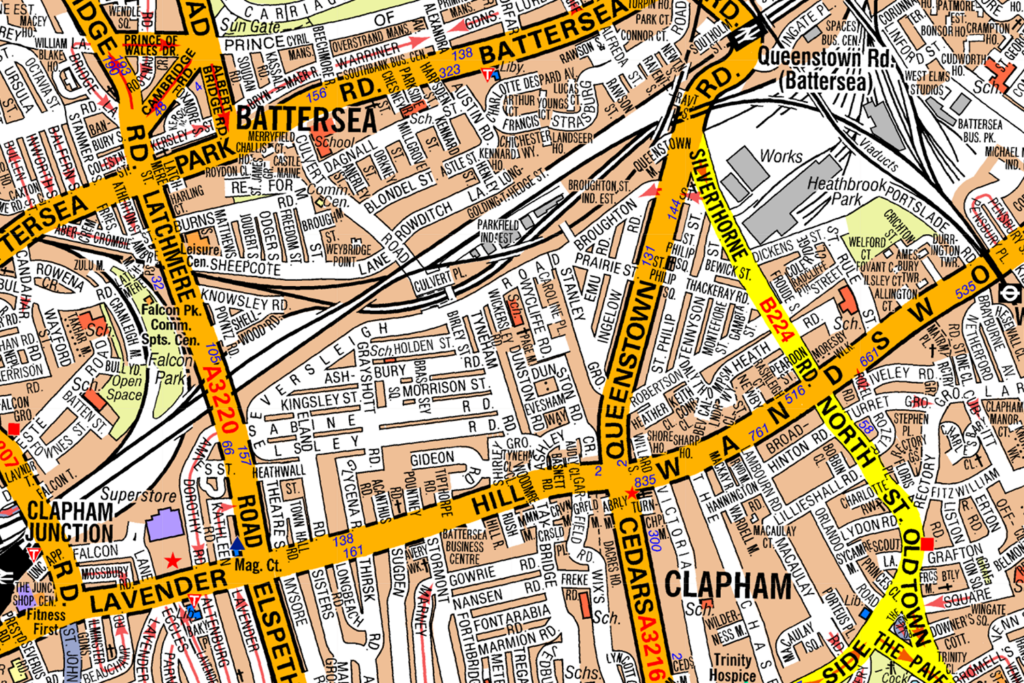
What direction is Battersea from Clapham?
CorrectIncorrect -
Question 28 of 98
28. Question
Look at the map.
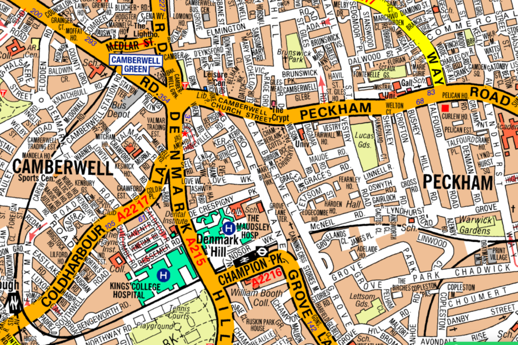
In which direction is Camberwell from Peckham?
CorrectIncorrect -
Question 29 of 98
29. Question
Look at the map.
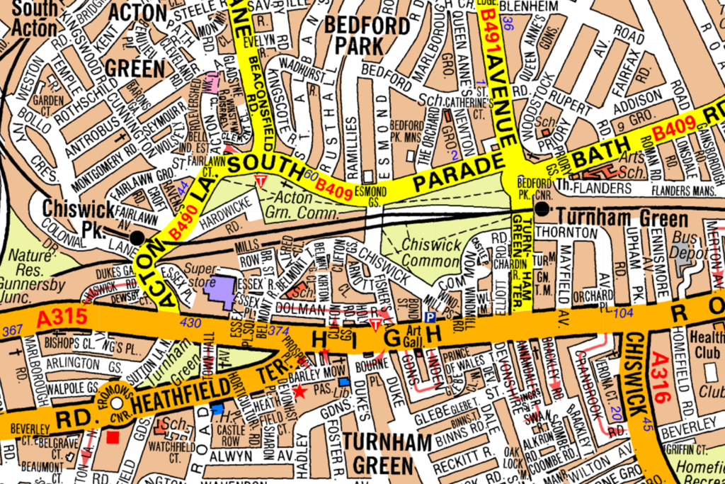
What direction is Bedford Park from Turnham Green?
CorrectIncorrect -
Question 30 of 98
30. Question
Look at the map.
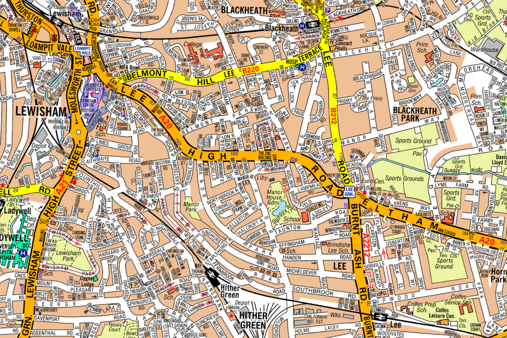
In what direction is Heather Green from Blackheath?
CorrectIncorrect -
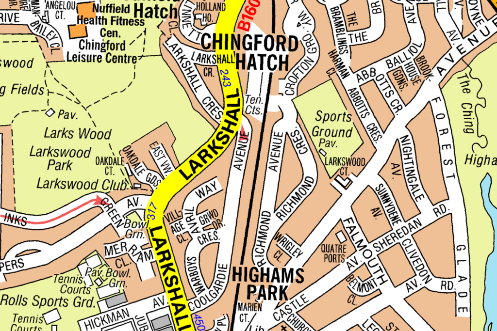
Question 31 of 98
31. Question
Look at the map. In what direction is Highams Park from Chingford Hatch?
 CorrectIncorrect
 -
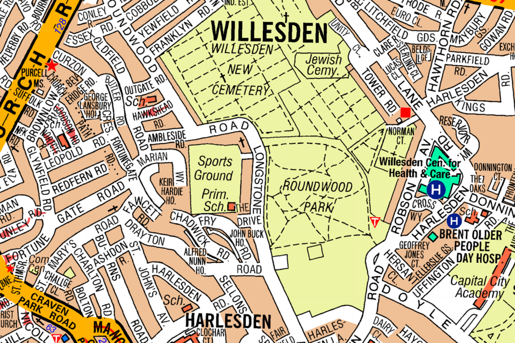
Question 32 of 98
32. Question
Look at the map. In what direction is Willesden from Harlesden?
 CorrectIncorrect
 -
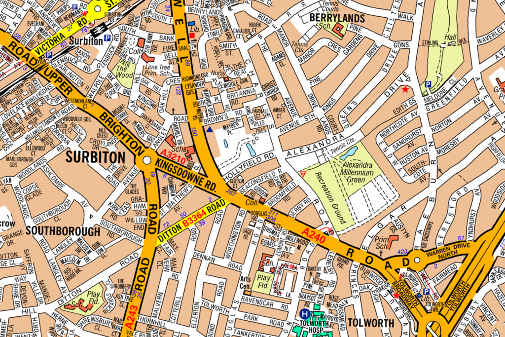
Question 33 of 98
33. Question
Look at the map. In what direction is Tolworth from Berrylands?
 CorrectIncorrect
 -
Question 34 of 98
34. Question
Look at the map.
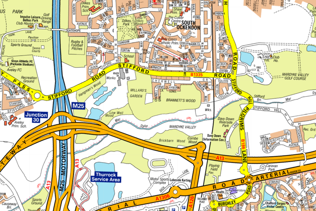
Which Motorway would you use to get to South Ockendon?
CorrectIncorrect -
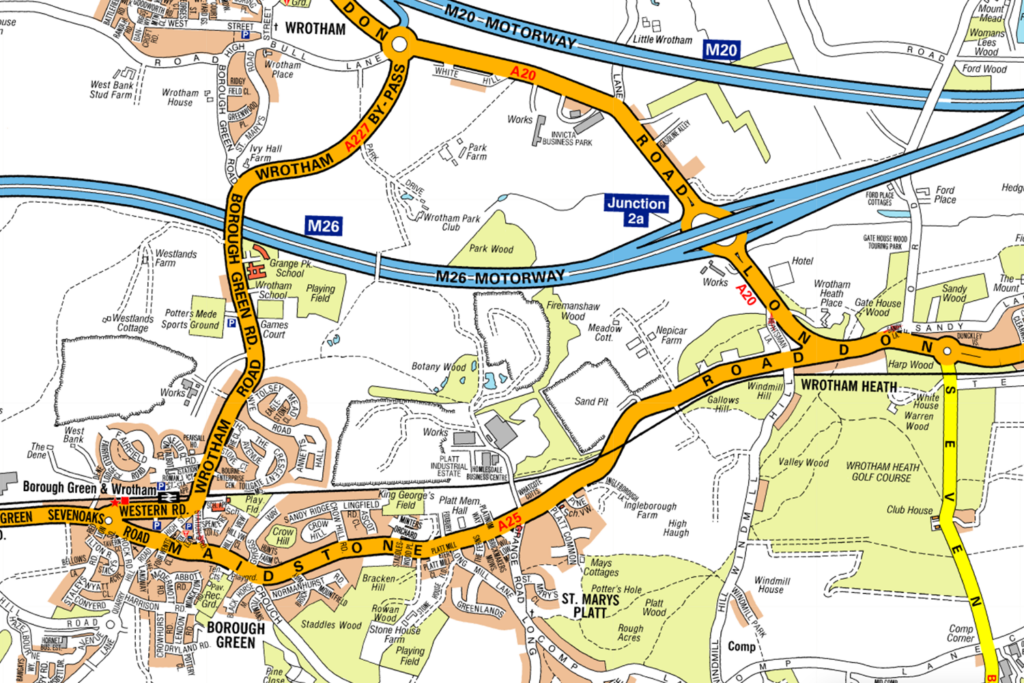
Question 35 of 98
35. Question
Look at the map. Which Motorway would you use to get to Borough Green?
 CorrectIncorrect
 -
Question 36 of 98
36. Question
Look at the map. Which Motorway would you use to get to Windlesham?
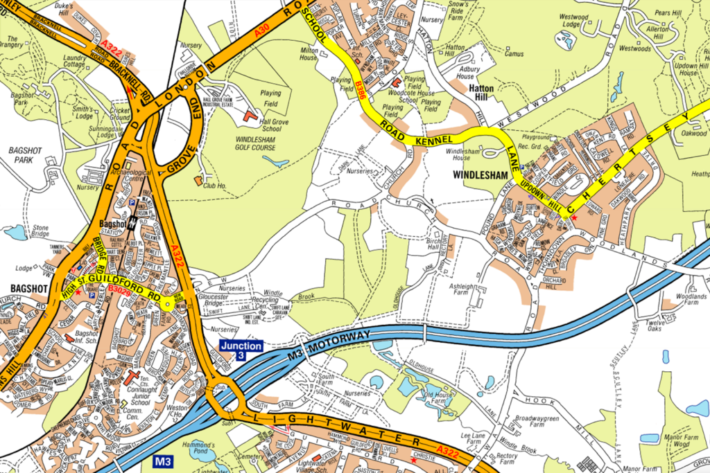 CorrectIncorrect
 -
Question 37 of 98
37. Question
Look at the map.
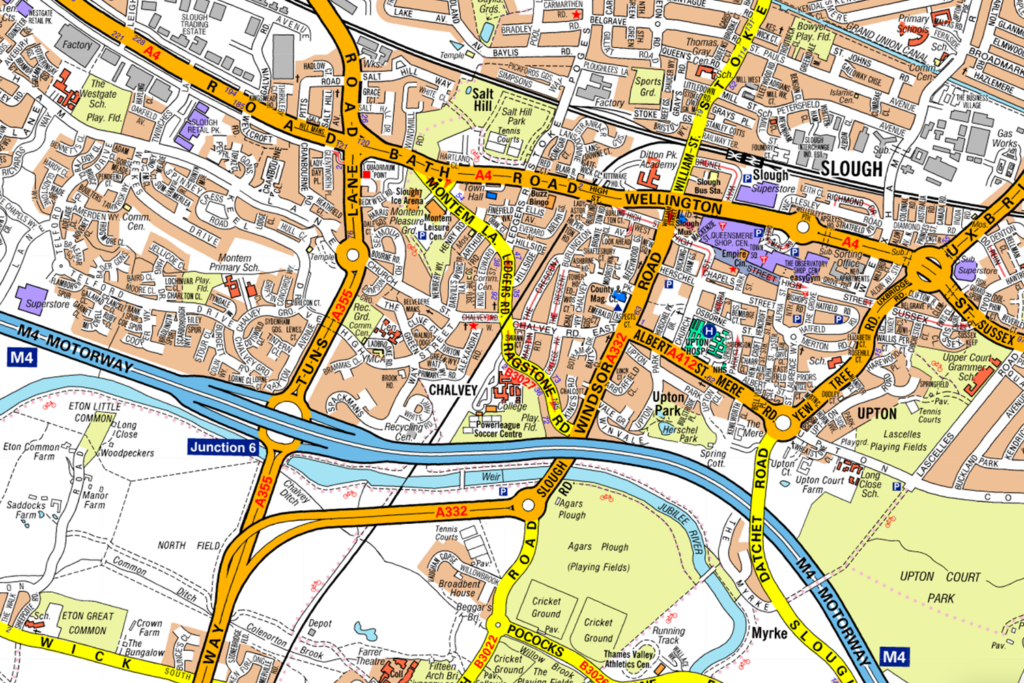
Which Junction on the M4 is nearest to Slough?
CorrectIncorrect -
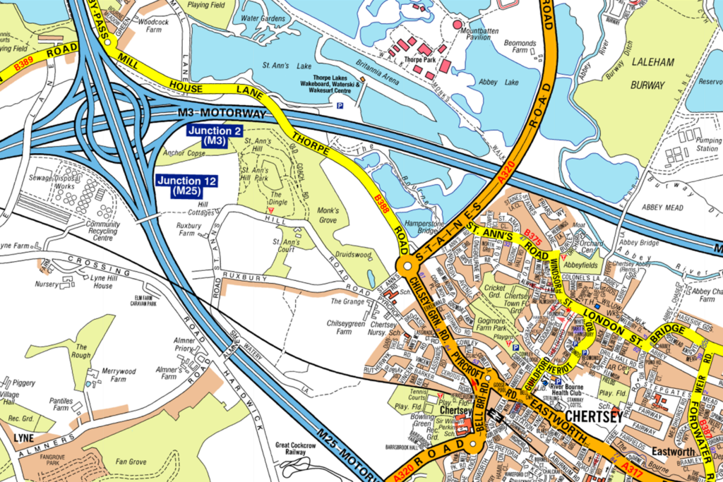
Question 38 of 98
38. Question
Look at the map.
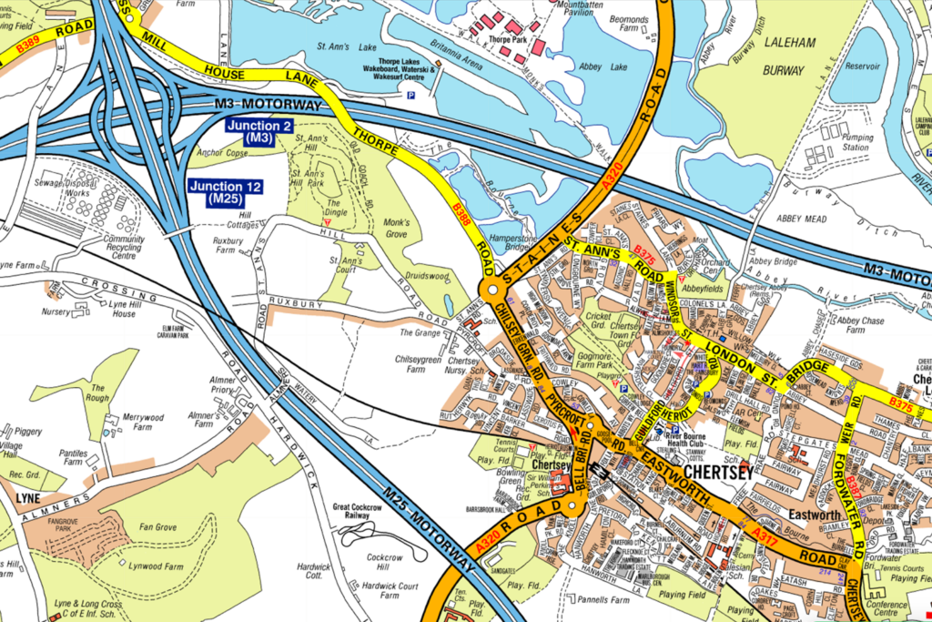
Which Junction on the M25 is nearest to Chertsey?
CorrectIncorrect -
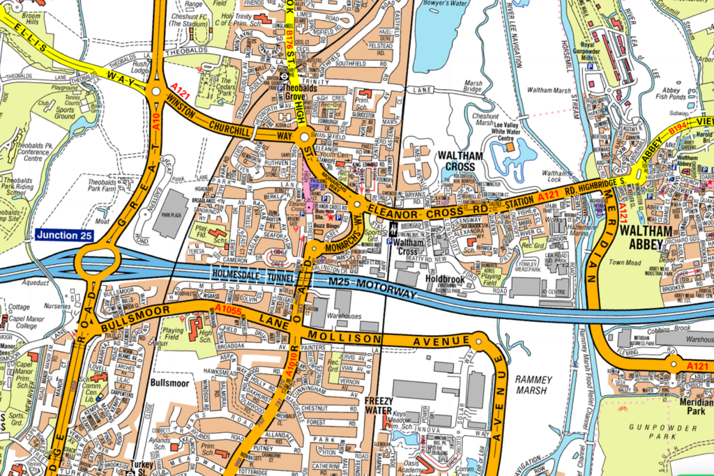
Question 39 of 98
39. Question
Look at the map. Which Junction on the M25 is nearest to Waltham Cross?
 CorrectIncorrect
 -
Question 40 of 98
40. Question
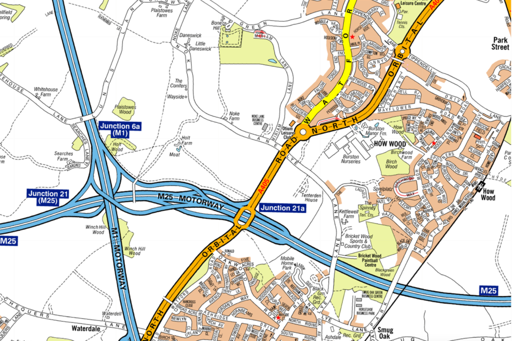
Look at the map. Which motorway is crossing the M25?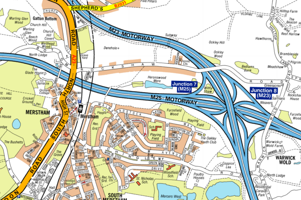 CorrectIncorrect
 -
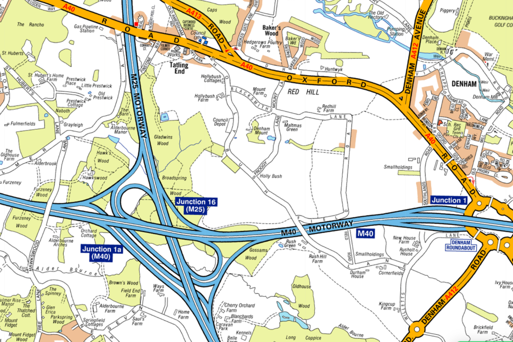
Question 41 of 98
41. Question
Look at the map. Which motorway is crossing the M25?
 CorrectIncorrect
 -
Question 42 of 98
42. Question
Look at the map. Which motorway is crossing the M25?
 CorrectIncorrect
 -
Question 43 of 98
43. Question
Look at the map. Which motorway is crossing the M25?
 CorrectIncorrect
 -
Question 44 of 98
44. Question
Look at the map. Which motorway is crossing the M25?
 CorrectIncorrect
 -
Question 45 of 98
45. Question
Look at the map. Which motorway is crossing the M25?
 CorrectIncorrect
 -
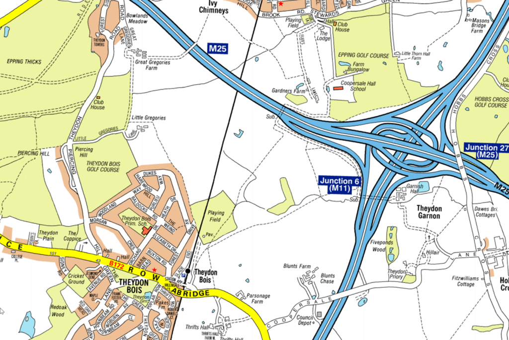
Question 46 of 98
46. Question
Look at the map.
Which motorway connects to the M25?
CorrectIncorrect -
Question 47 of 98
47. Question
Look at the map.
Which motorway connects to the M25?
CorrectIncorrect -
Question 48 of 98
48. Question
Look at the map. Which motorway connects to the M25?
 CorrectIncorrect
 -
Question 49 of 98
49. Question
Look at the map.
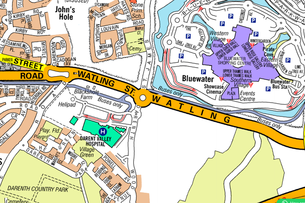
What is the nearest shopping centre to Watling Street?
CorrectIncorrect -
Question 50 of 98
50. Question
Look at the map.

On which road is the British Library?
CorrectIncorrect -
Question 51 of 98
51. Question
Look at the map.
Which of the following public buildings are shown? (select two)
CorrectIncorrect -
Question 52 of 98
52. Question
Look at the map.
What is the nearest shopping centre to Prince Charles Drive?
CorrectIncorrect -
Question 53 of 98
53. Question
Look at the map.
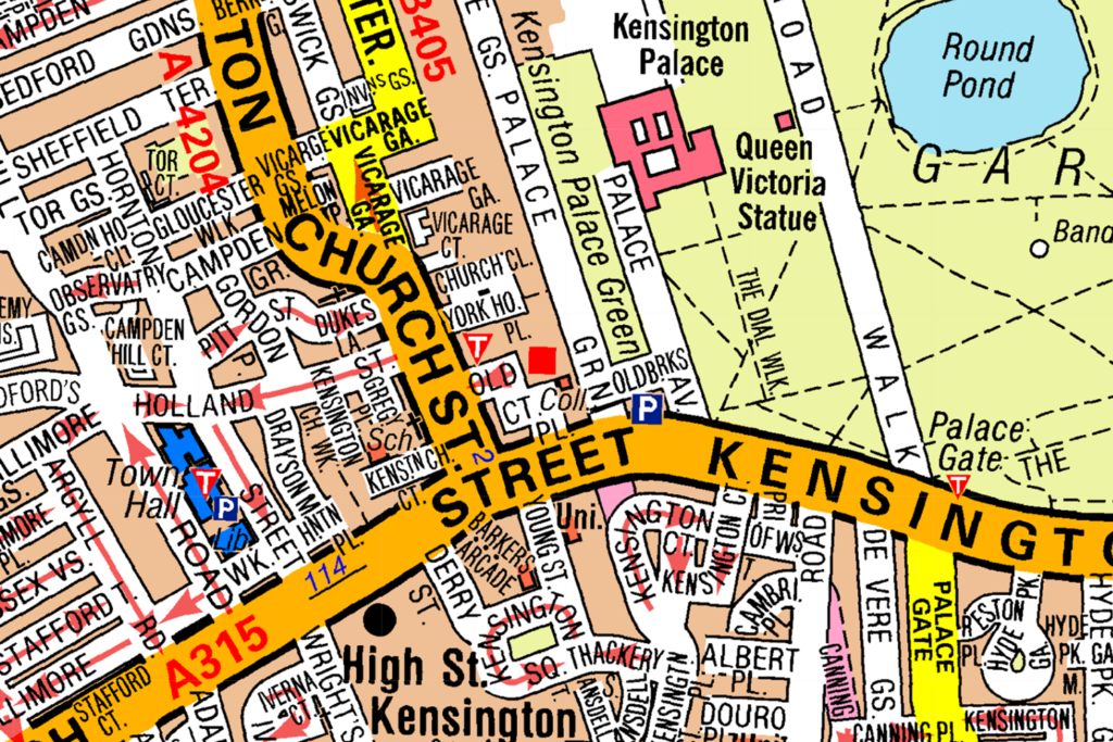
What is the nearest station to Kensington Palace?
CorrectIncorrect -
Question 54 of 98
54. Question
Look at the map.
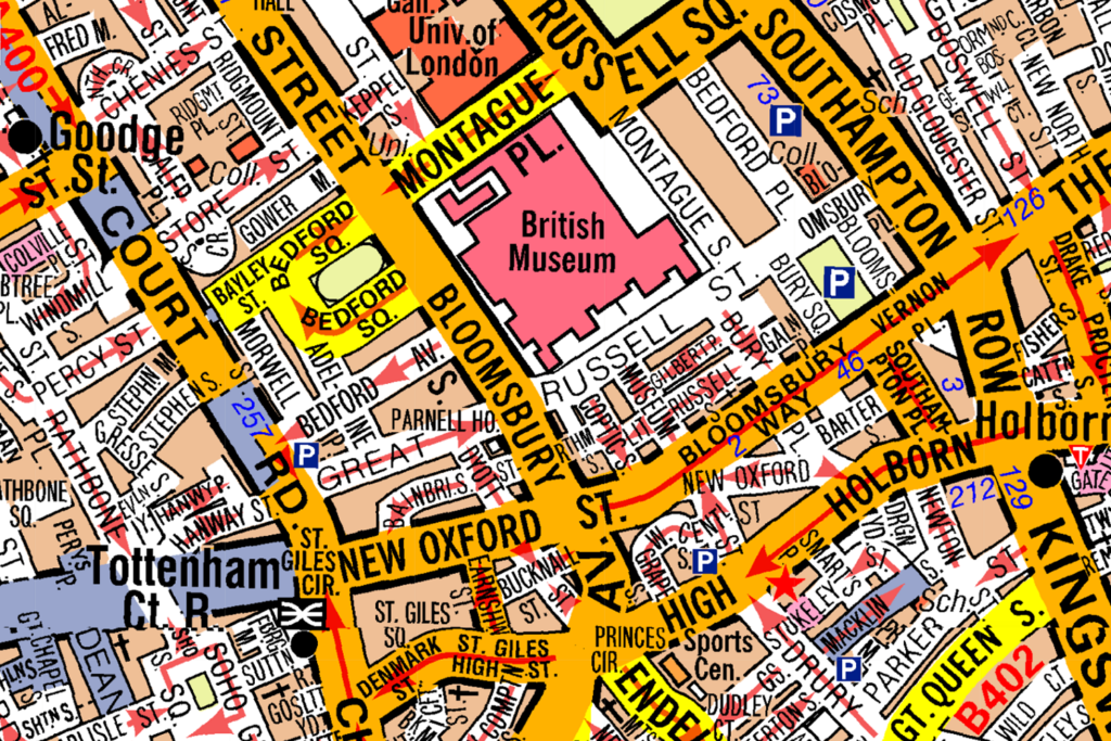
What is the nearest Crossrail Station to the British Museum?
CorrectIncorrect -
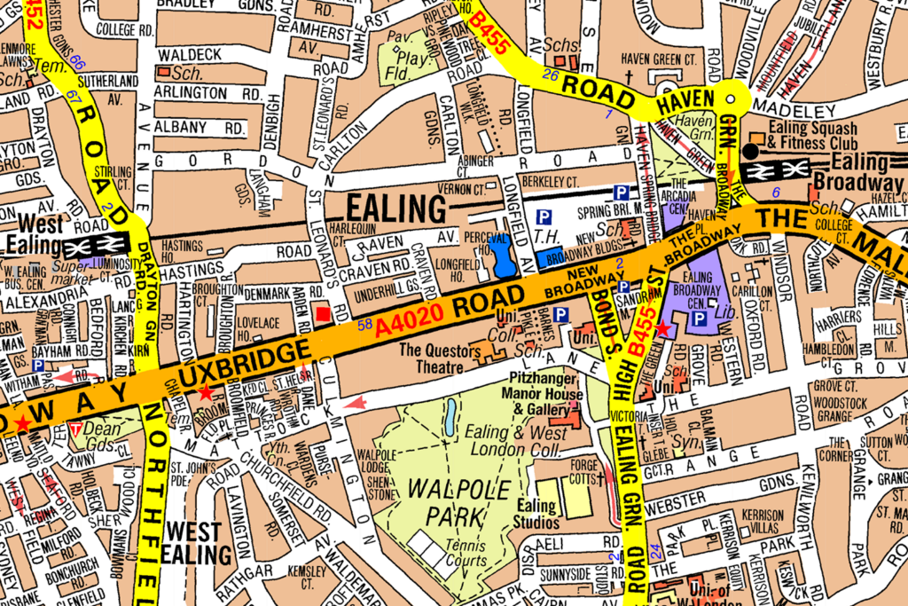
Question 55 of 98
55. Question
Look at the map.
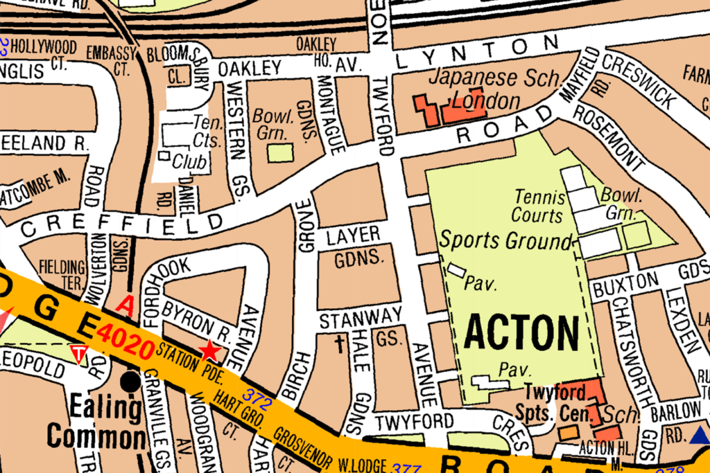
Which building can be see on Creffield Road?
CorrectIncorrect -
Question 56 of 98
56. Question
Look at the map.
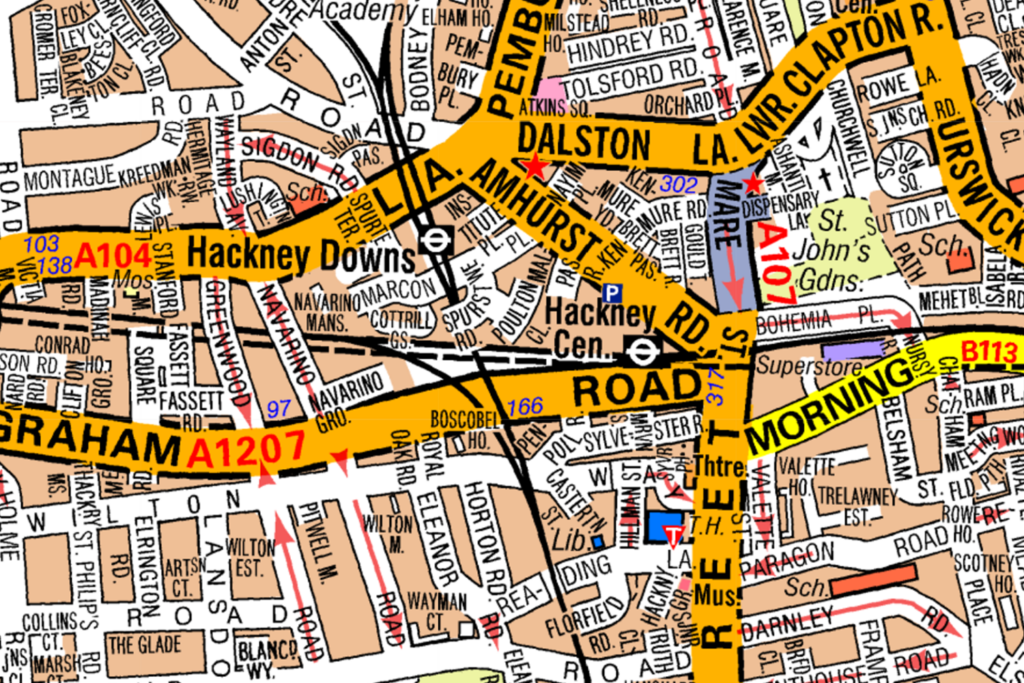
Which road is closest to Hackney Downs Overground Station?
CorrectIncorrect -
Question 57 of 98
57. Question
Look at the map.
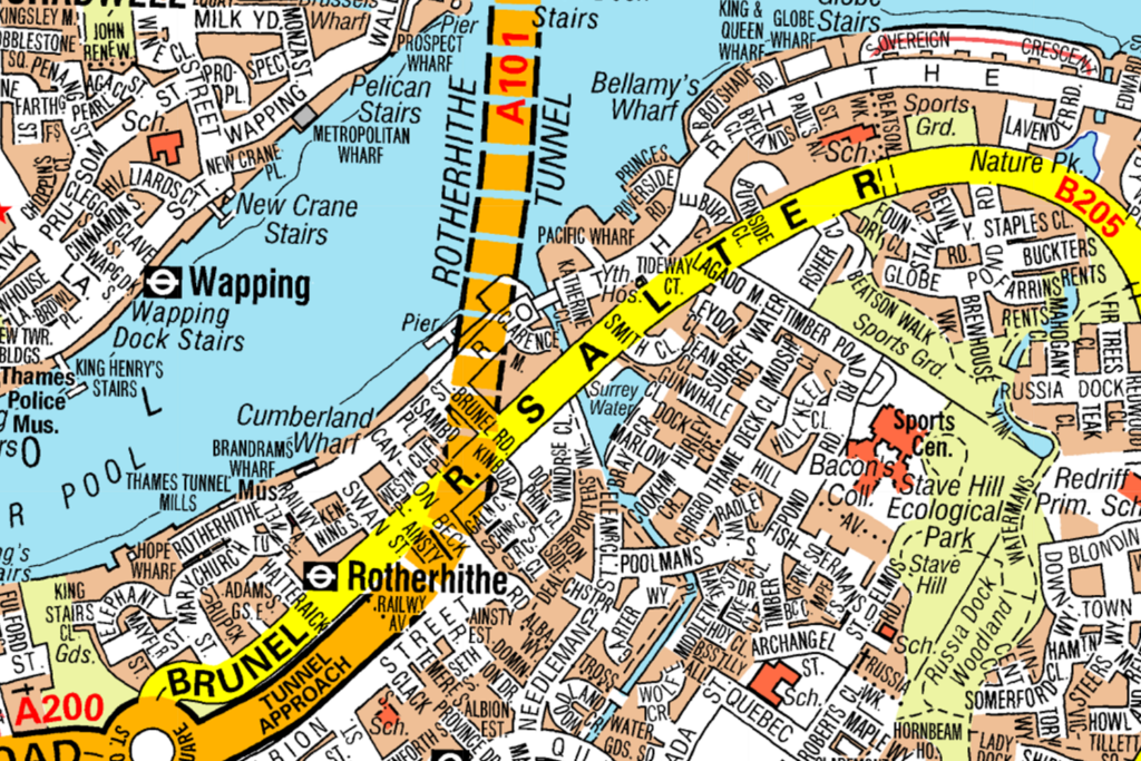
What is the nearest road to Rotherhite Overground Station?
CorrectIncorrect -
Question 58 of 98
58. Question
Look at the map.
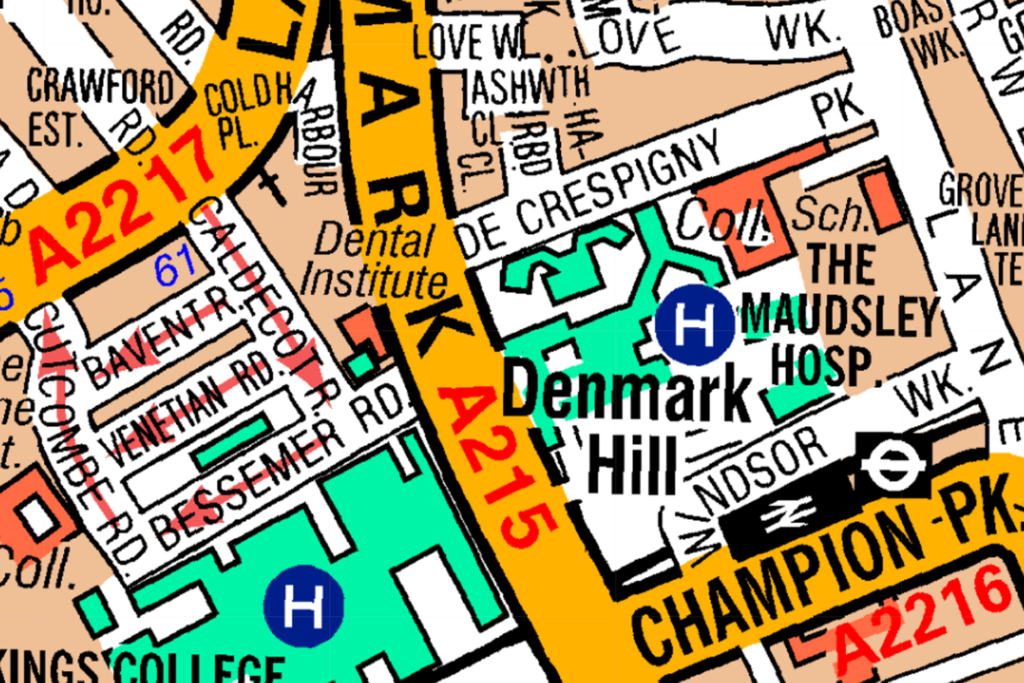
What road is closest to Denmark Hill National Rail Station?
CorrectIncorrect -
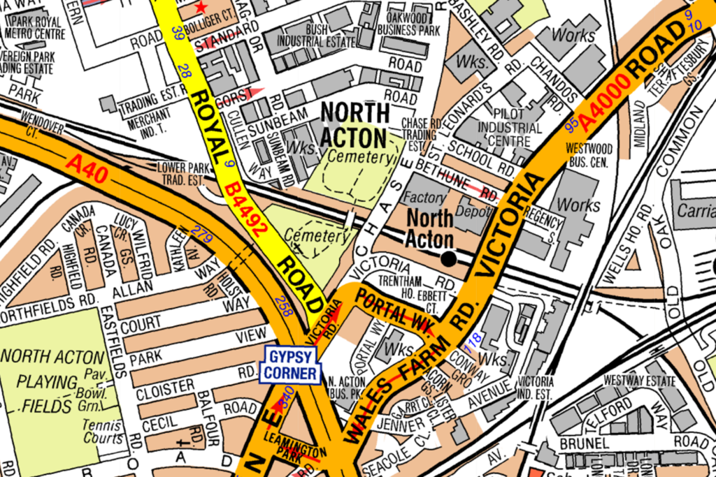
Question 59 of 98
59. Question
Look at the map.
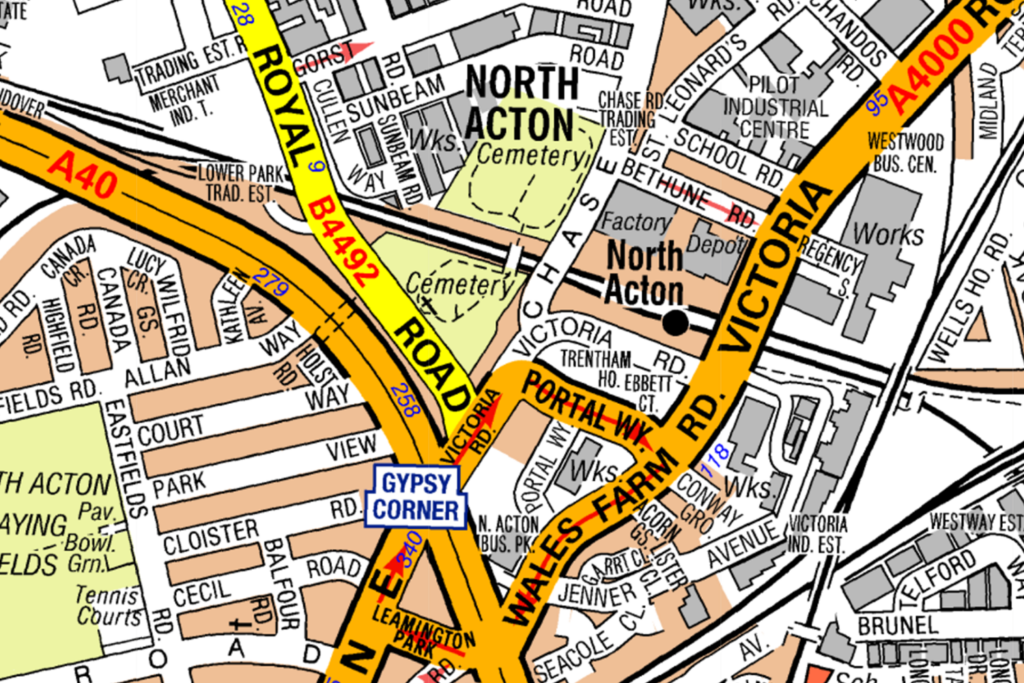
What is the nearest road to North Acton Underground Station?
CorrectIncorrect -
Question 60 of 98
60. Question
Look at the map.
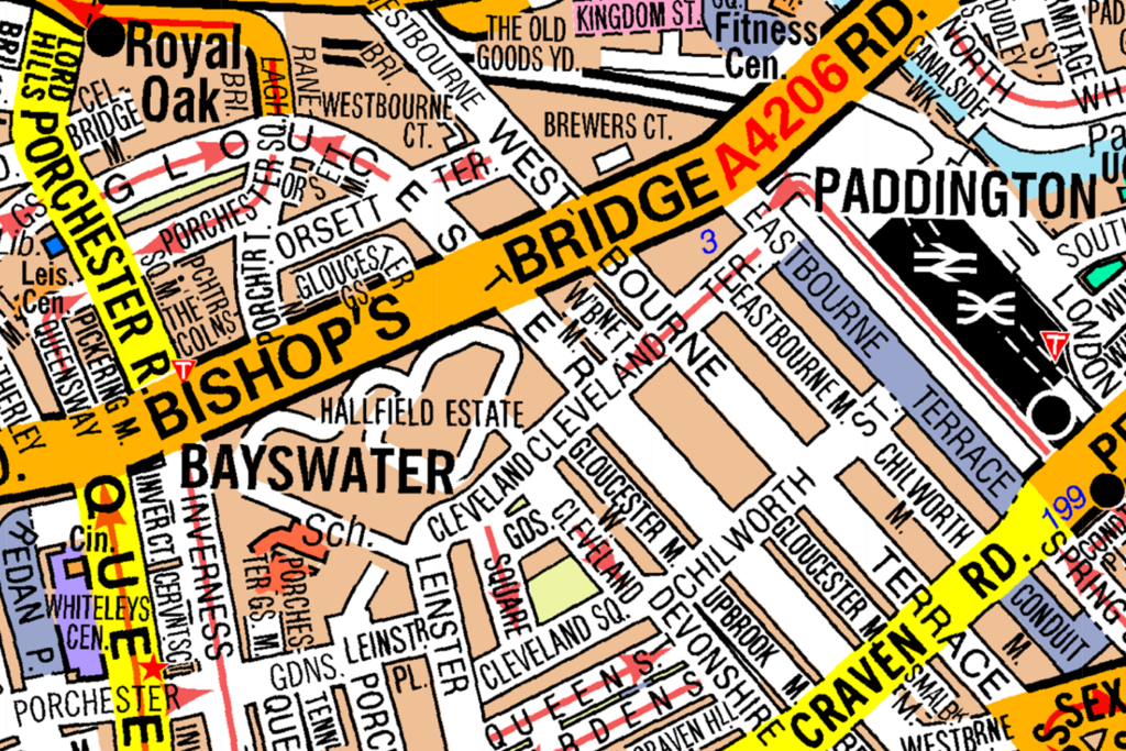
From Craven Road you can turn left into Eastbourne Terrace:
CorrectIncorrect -
Question 61 of 98
61. Question
Look at the map.
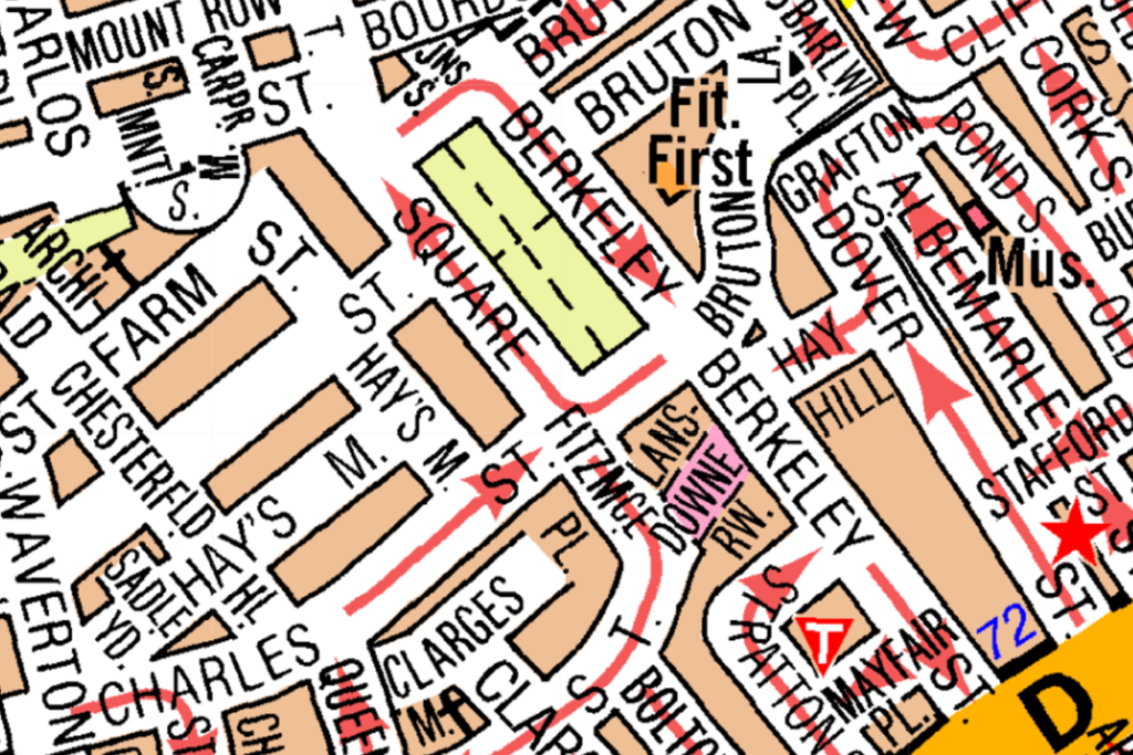
The nearest Pedestrian Zone to Berkley Square is on Farm St:
CorrectIncorrect -
Question 62 of 98
62. Question
Look at the map.
The nearest pedestrian zone to King’s Cross Station is Good’s Way:
CorrectIncorrect -
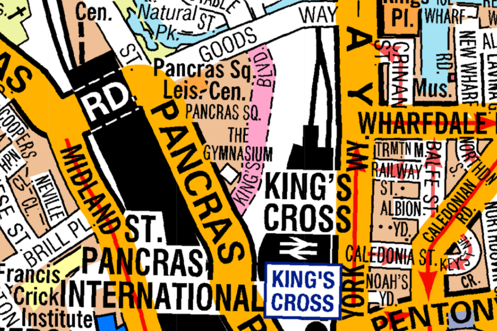
Question 63 of 98
63. Question
Look at the map.
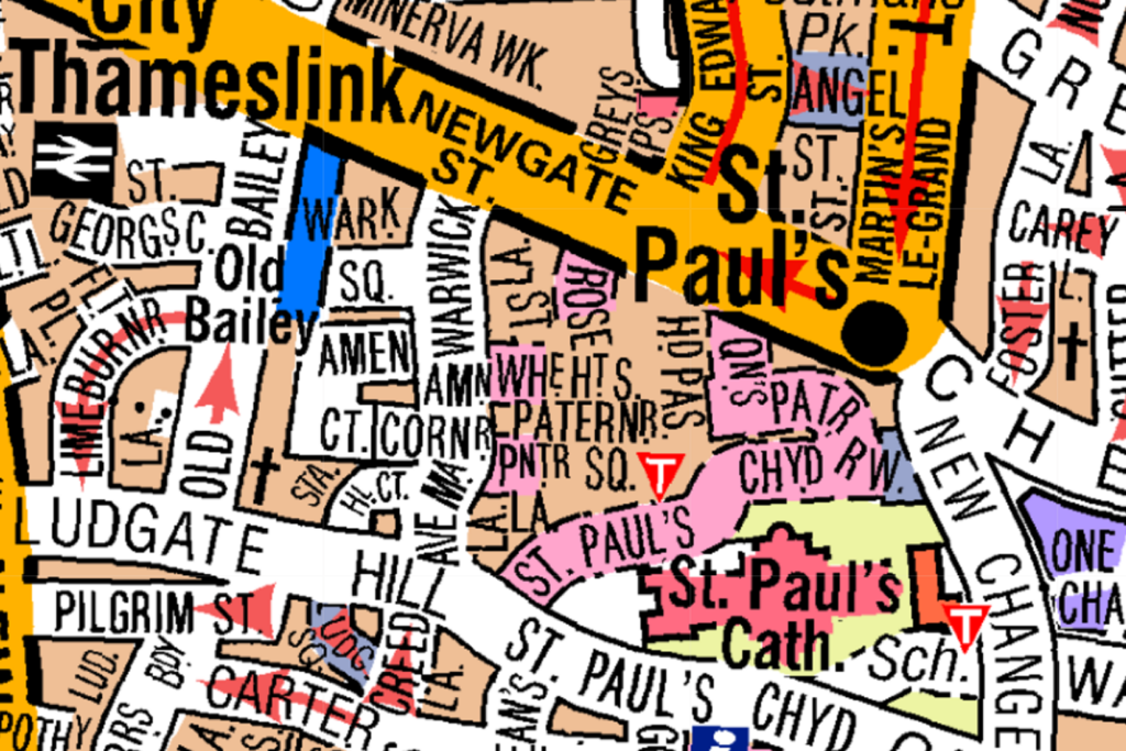
The nearest pedestrian zone to St Paul’s Station is Ludgate Hill:
CorrectIncorrect -
Question 64 of 98
64. Question
Look at the map. From Old Post Office Lane you can drive up to Paddock Close:
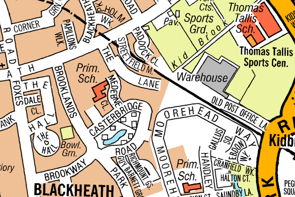 CorrectIncorrect
 -
Question 65 of 98
65. Question
Look at the map. From Dawes Street you cannot turn left onto East Street:
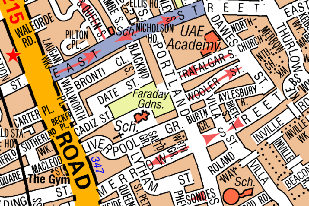 CorrectIncorrect
 -
Question 66 of 98
66. Question
Look at the map. From Victoria Road you can turn onto Bethune Road:
 CorrectIncorrect
 -
Question 67 of 98
67. Question
Look at the map.
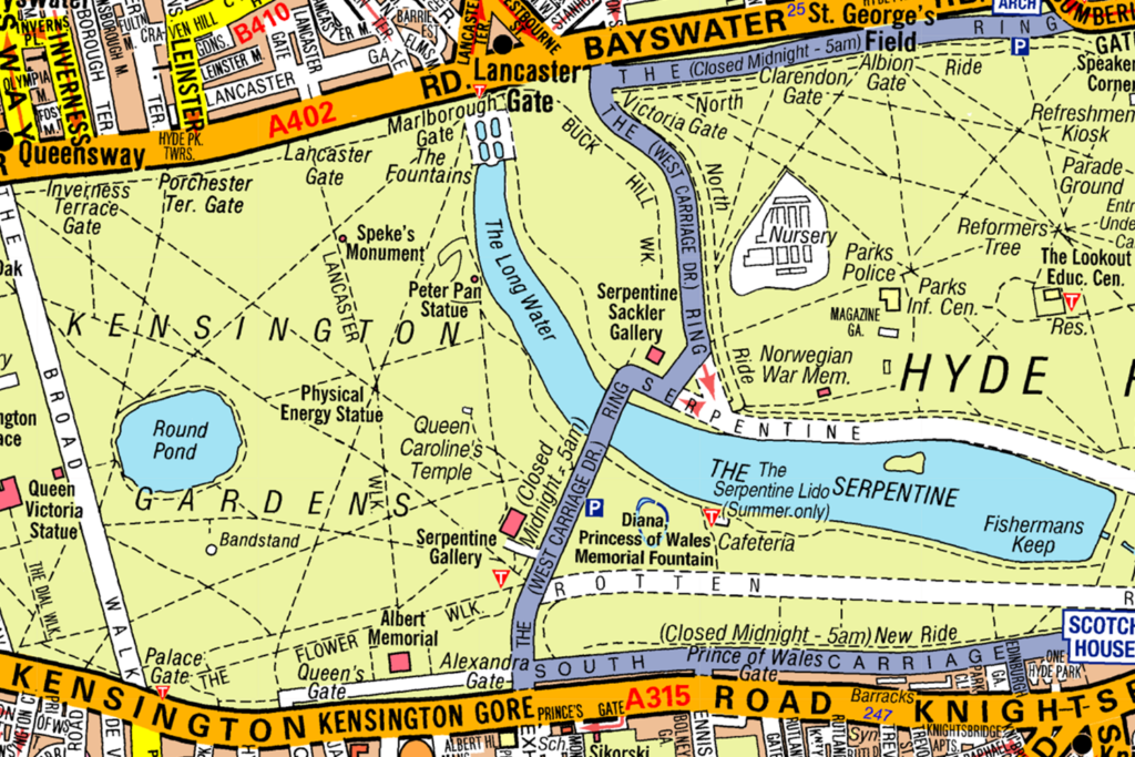
From Bayswater you can turn left onto The West Carriage Drive:
CorrectIncorrect -
Question 68 of 98
68. Question
Look at the map.
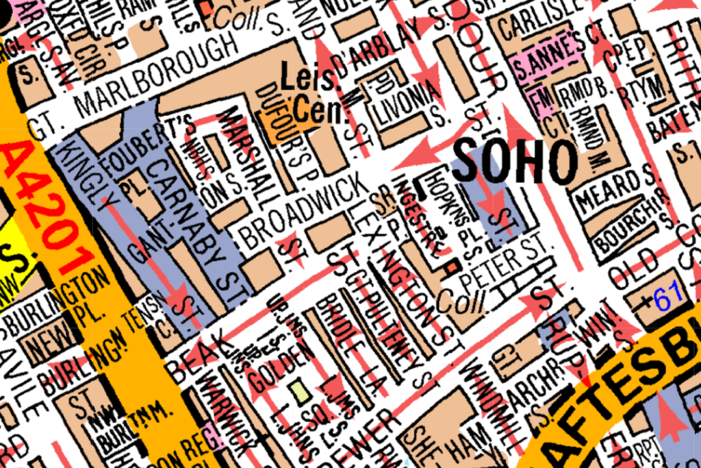
From Beak Street, you can turn right onto Carnaby Street:
CorrectIncorrect -
Question 69 of 98
69. Question
Look at the map.
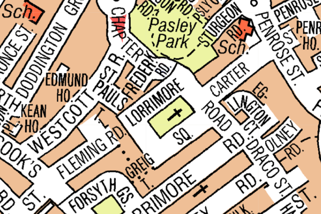
From Freder Road you can turn right onto Lorrimore Square:
CorrectIncorrect -
Question 70 of 98
70. Question
Look at the map.
From Barham Road you cannot turn right onto Ellerton Road:
CorrectIncorrect -
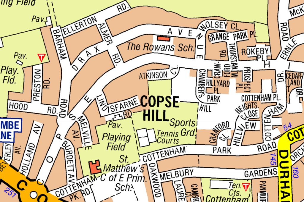
Question 71 of 98
71. Question
Look at the map.
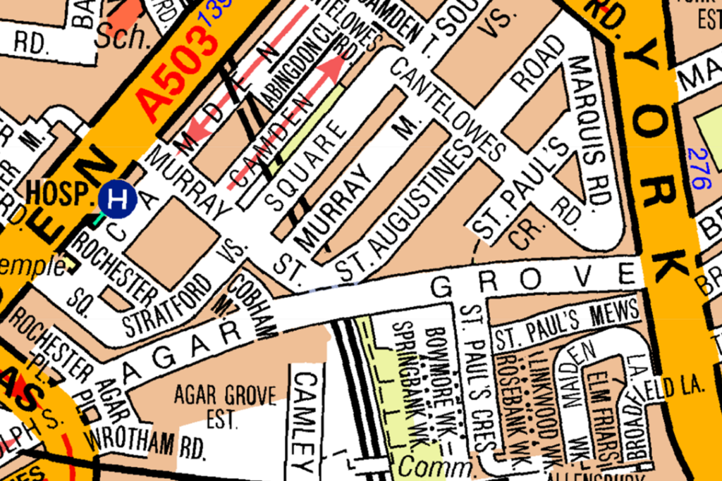
From Agar Grove you cannot turn onto Murray Street:
CorrectIncorrect -
Question 72 of 98
72. Question
Look at the map.
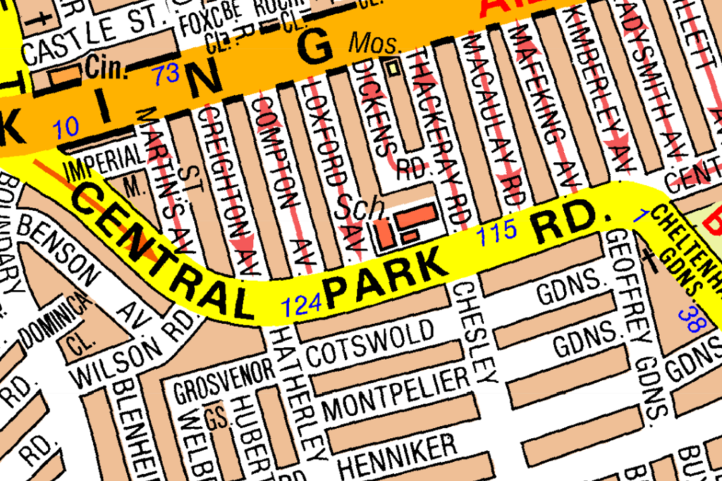
From Central Park Road you can turn left onto Macaulay Road:
CorrectIncorrect -
Question 73 of 98
73. Question
Look at the map.
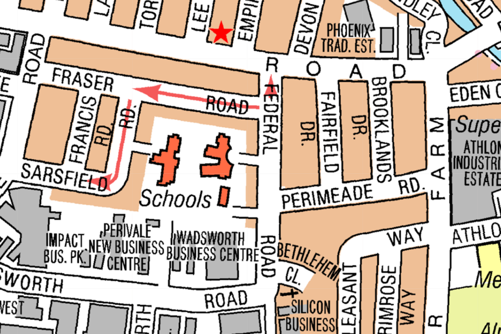
From Sarsfield Road you can turn onto Fraser Road:
CorrectIncorrect -
Question 74 of 98
74. Question
Look at the map.
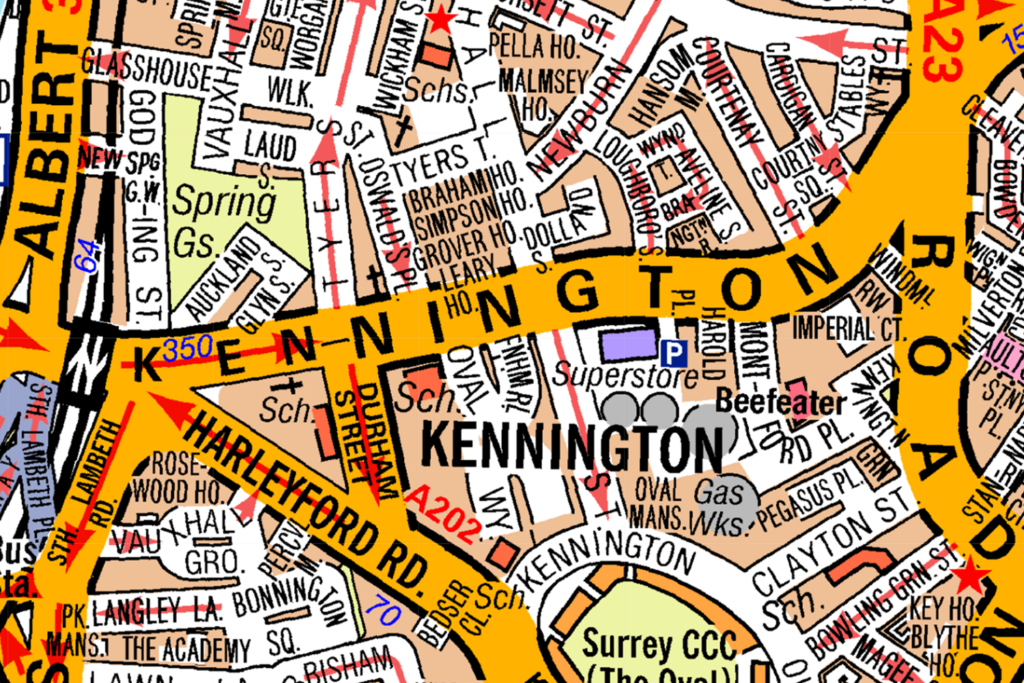
From Kennington Road you cannot turn left onto Oswald Place:
CorrectIncorrect -
Question 75 of 98
75. Question
Look at the map.
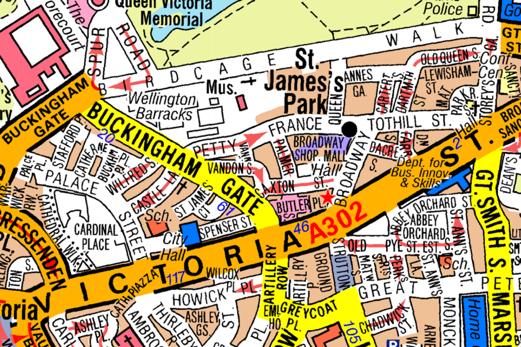
Which roads join A302? (Select two)
CorrectIncorrect -
Question 76 of 98
76. Question
Look at the map.
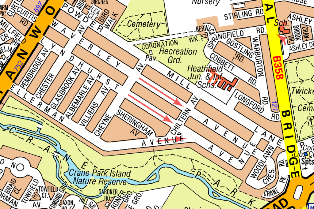
Which roads run parallel to Powder Mill Lane? (Select two)
CorrectIncorrect -
Question 77 of 98
77. Question
Look at the map.
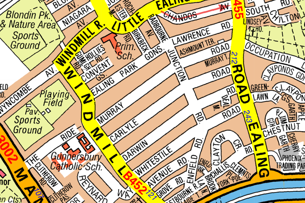
Which roads run parallel to Murray Road? (Select two)
CorrectIncorrect -
Question 78 of 98
78. Question
Look at the map. Which roads run parallel to Caledon? (Select two)
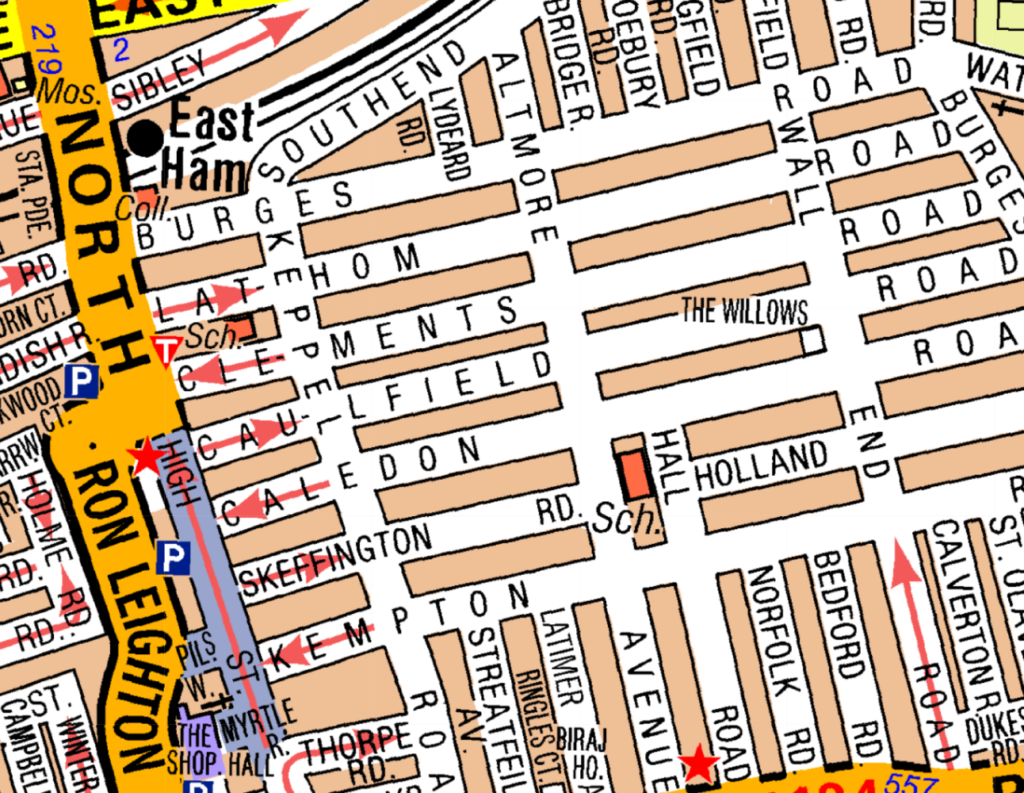 CorrectIncorrect
 -
Question 79 of 98
79. Question
Look at the map.
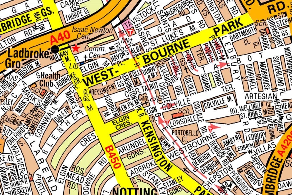
Which roads join B450? (Select two)
CorrectIncorrect -
Question 80 of 98
80. Question
Look at the map.
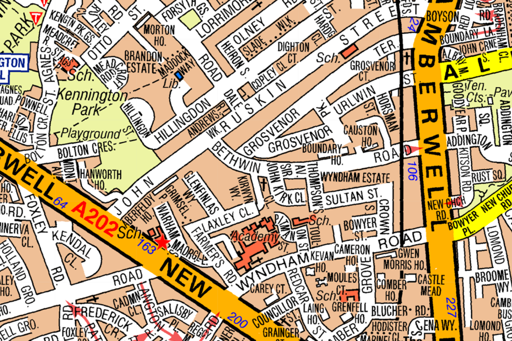
Which roads join A202? (Select two)
CorrectIncorrect -
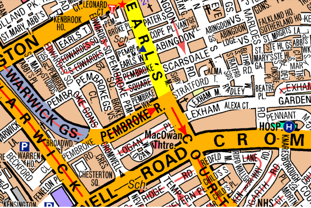
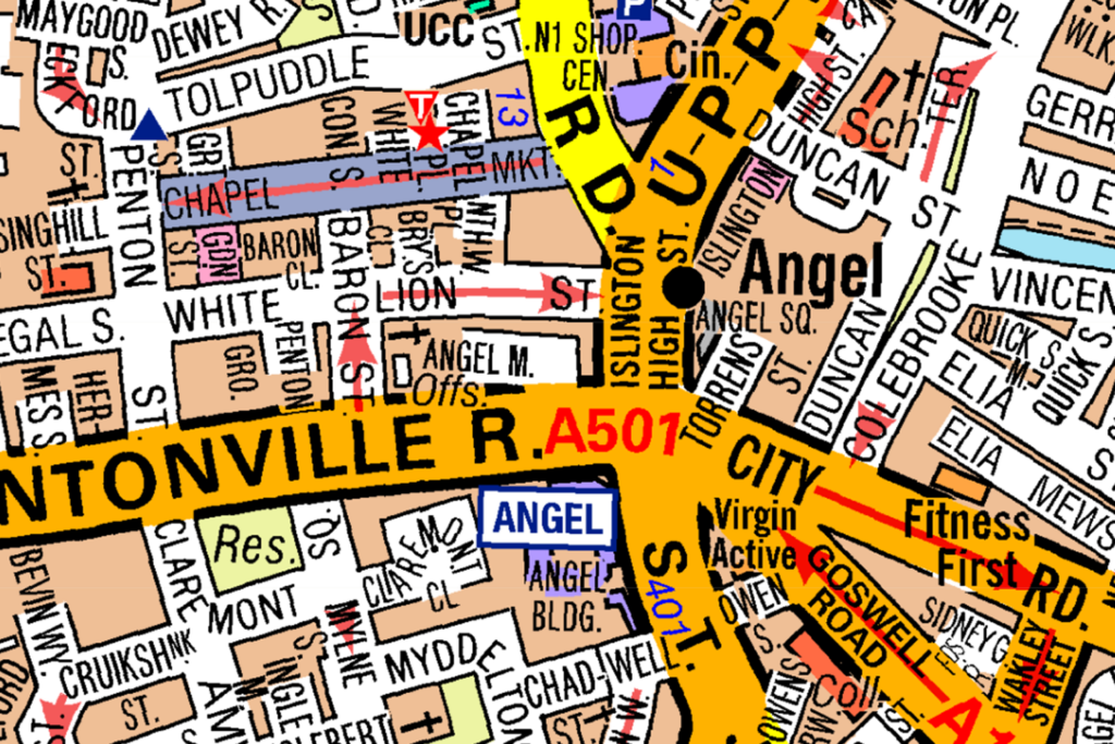
Question 81 of 98
81. Question
Look at the map. Which roads join A501? (Select two)
 CorrectIncorrect
 -
Question 82 of 98
82. Question
Look at the map.
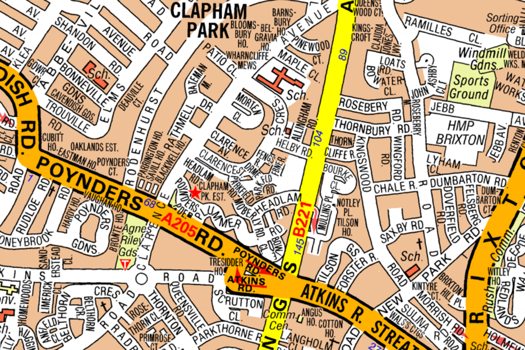
Which two roads cross A205? (Select 2 answers)
CorrectIncorrect -
Question 83 of 98
83. Question
Look at the map.

Which roads cross Tufnell Park Road? (Select two)
CorrectIncorrect -
Question 84 of 98
84. Question
Look at the map. Which roads cross A3217? (Select two)
 CorrectIncorrect
 -
Question 85 of 98
85. Question
Look at the map.
Which roads cross Franciscan Road? (Select two)
CorrectIncorrect -
Question 86 of 98
86. Question
Look at the map. Which roads run parallel to Devereux Road? (Select two)
 CorrectIncorrect
 -
Question 87 of 98
87. Question
Look at the map. What is the closest Crossrail Station to London City Airport?
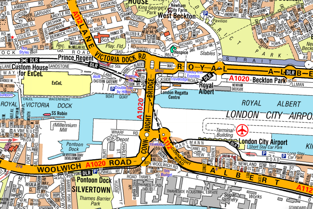 CorrectIncorrect
 -
Question 88 of 98
88. Question
Look at the map.
What is the nearest underground station to the fire station shown?
CorrectIncorrect -
Question 89 of 98
89. Question
Look at the map.
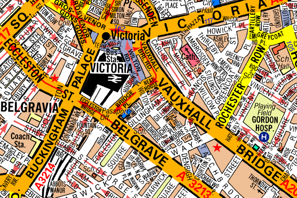
The nearest post office to Victoria Station is on which road?
CorrectIncorrect -
Question 90 of 98
90. Question
Look at the map.
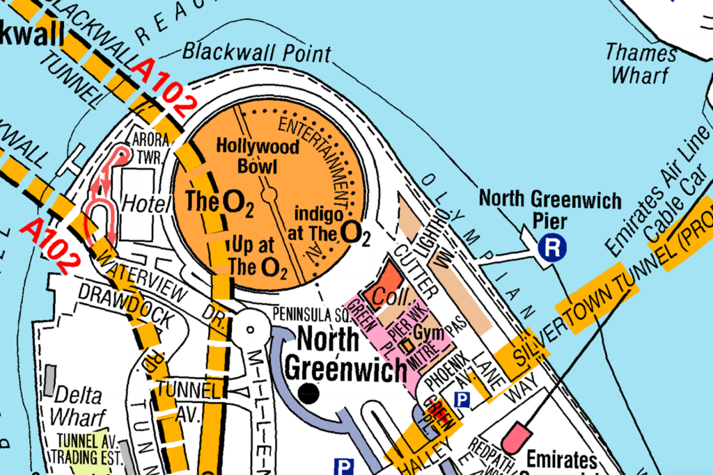
What is the nearest river bus stop to The O2?
CorrectIncorrect -
Question 91 of 98
91. Question
Look at the map.
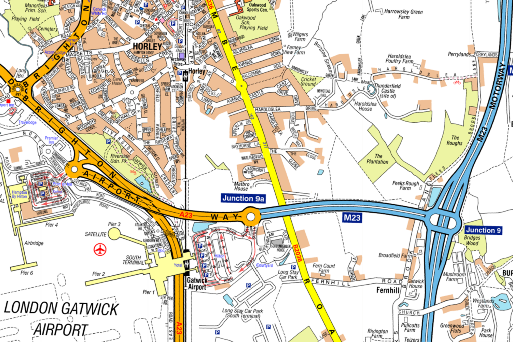
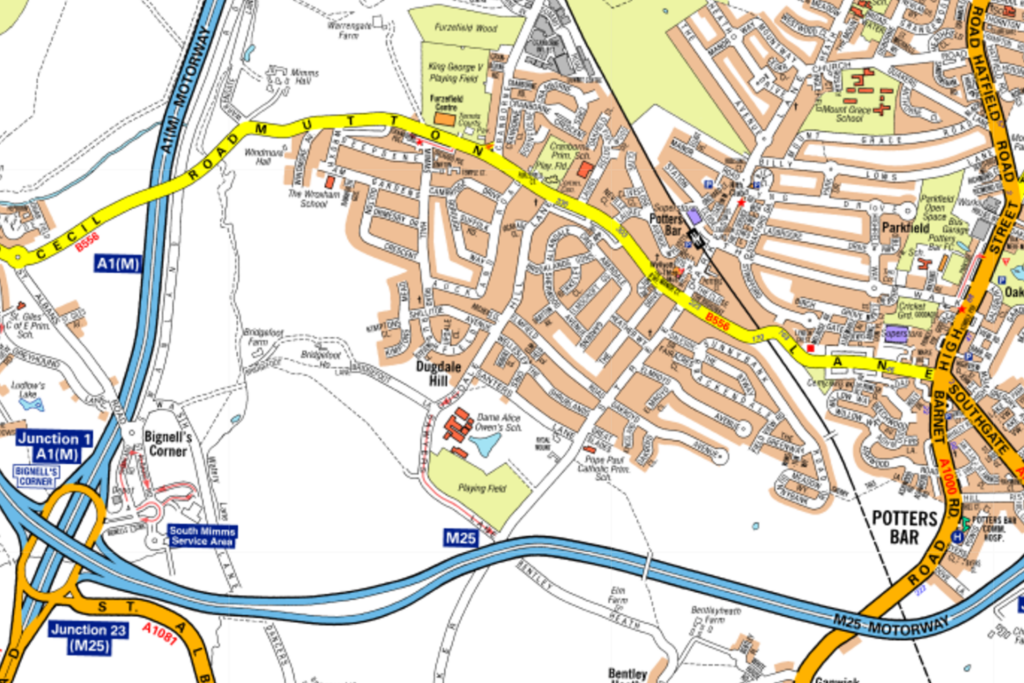
What is the closest junction on the M23 to London Gatwick Airport?
CorrectIncorrect -
Question 92 of 98
92. Question
Look at the map.
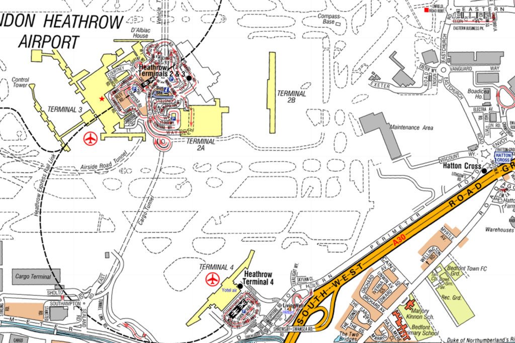
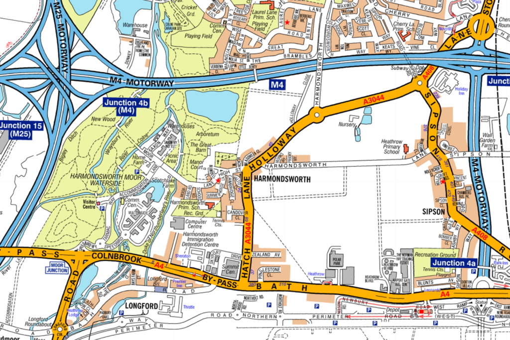
What is the nearest underground station to Heathrow Terminal 4?
CorrectIncorrect -
Question 93 of 98
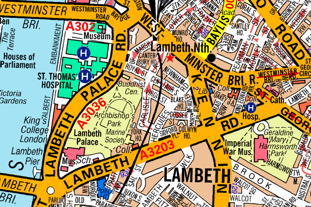
93. Question
Look at the map.
On which road is the police station shown?
CorrectIncorrect -
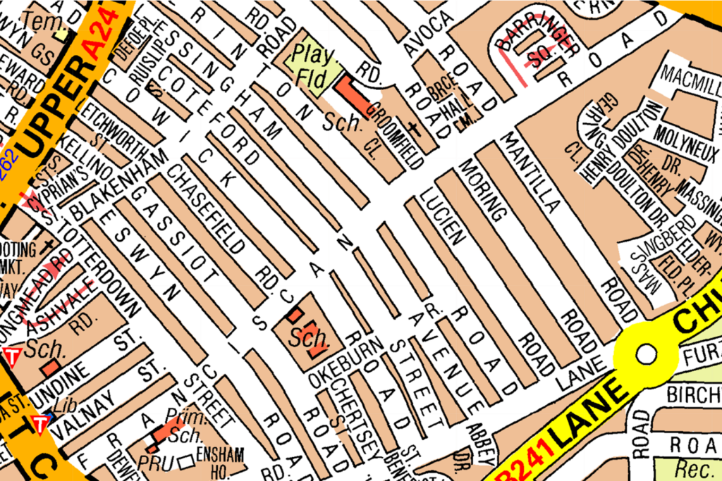
Question 94 of 98
94. Question
Look at the map.
The police station shown is located on the crossing between which roads? (Select two answers)
CorrectIncorrect -
Question 95 of 98
95. Question
Look at the map.
What is the nearest overground station to the police station shown?
CorrectIncorrect -
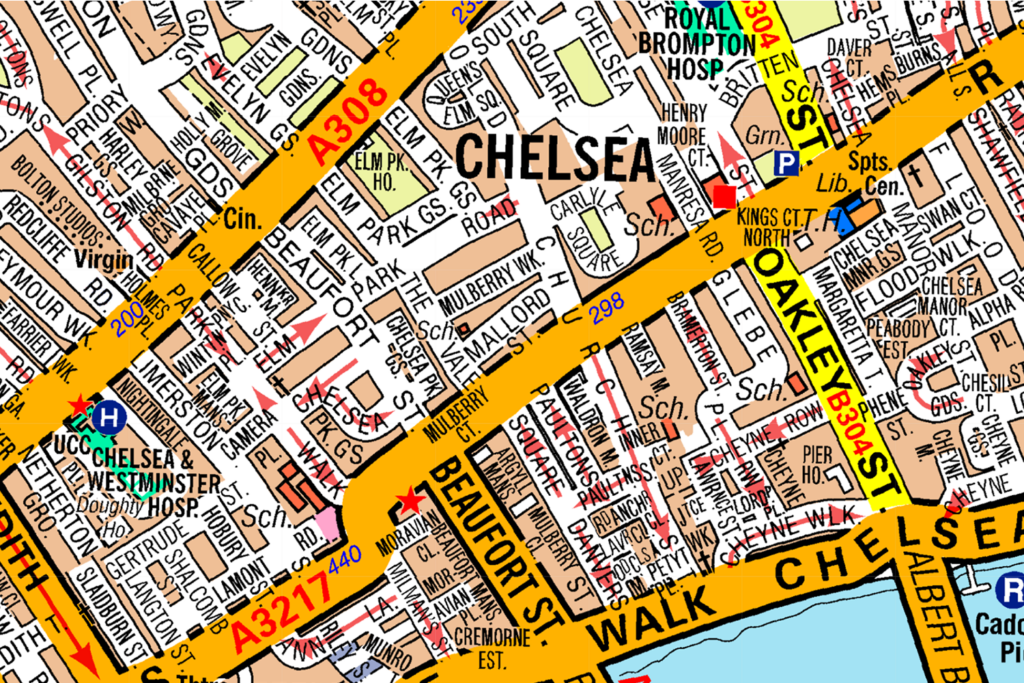
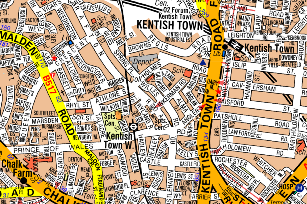
Question 96 of 98
96. Question
Look at the map.
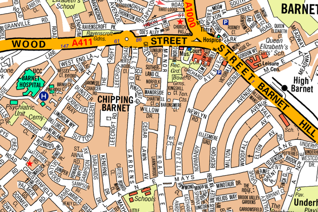
What is the nearest underground station to the hospital shown?
CorrectIncorrect -
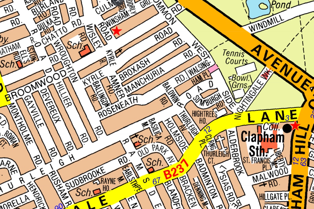
Question 97 of 98
97. Question
Look at the map.
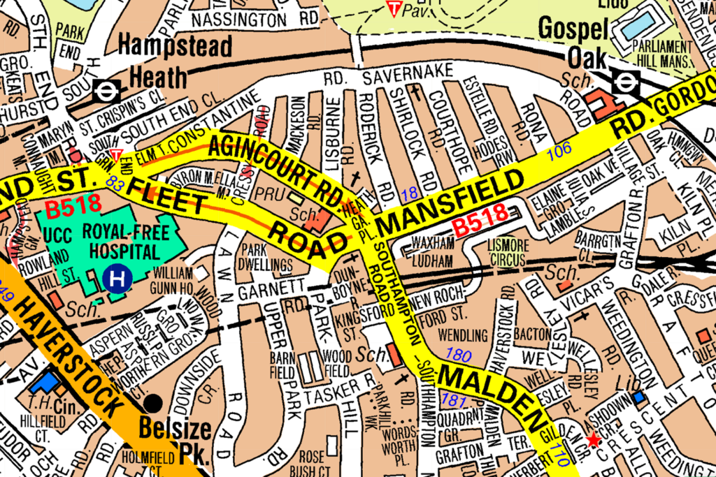
What is the nearest underground station to the hospital shown?
CorrectIncorrect -
Question 98 of 98
98. Question
Look at the map.
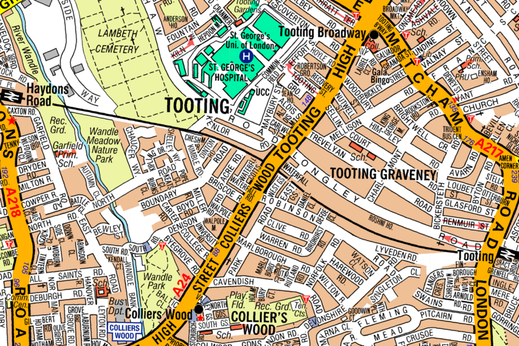
What is the nearest underground station to the hospital shown?
CorrectIncorrect